A transport aircraft from the US carrying a NASA-ISRO satellite landed in Bengaluru on March 8.
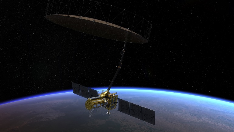
The C-17 plane airlifted off California with the NASA-ISRO Synthetic Aperture (NISAR) satellite for a joint mission to measure changes in Earth’s crust and land ice surfaces. The 2,800 kg satellite can penetrate through clouds and can produce high-resolution images regardless of weather conditions. It will be used to protect the earth from all kinds of threats. The satellite, which to be launched in 2024 from the Satish Dhawan Space Centre in Andhra Pradesh, will also be used for various purposes, including agricultural mapping and landslide detection.
The NISAR is equipped with L-band and S-band S-band Synthetic Aperture Radar, due to which it is called a dual-frequency imaging radar satellite. It continuously collects data regardless of weather conditions, allowing it to study the Earth in greater detail than ever before. The satellite’s 39-foot reflector antenna and radar will help collect data. The data collected will lead to a better understanding of the Earth’s upper crust and dynamics, leading to a better understanding of the scientific causes of the planet’s changing climate.


